
A little gem in Anglesey - Din LLigwy hut group, an amazing 3rd -4th century settlement that few people have heard of or visited!
/What is there to see?
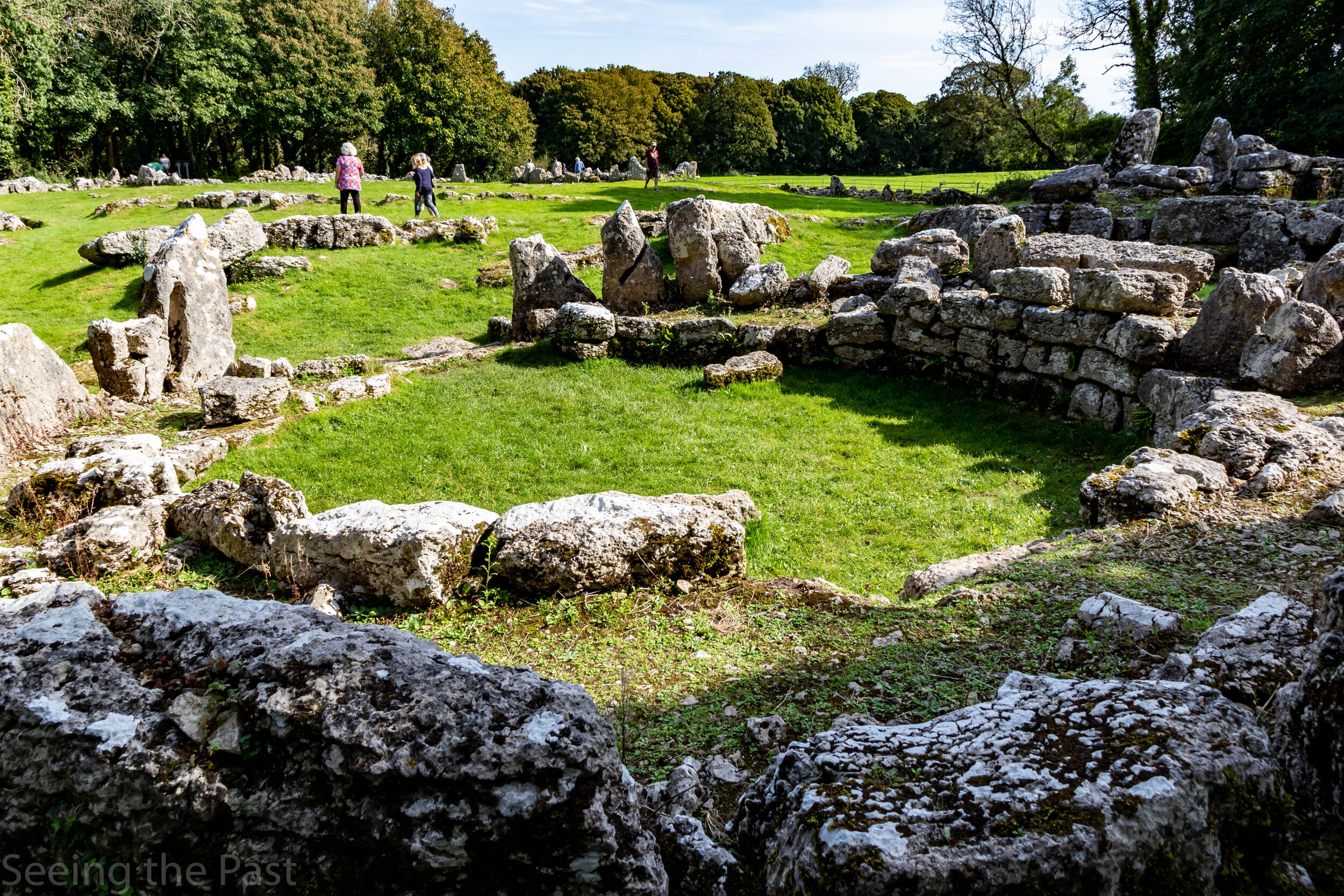
The foundations of two round huts and several rectangular buildings surrounded by a five foot high stone wall. The whole thing covers an area of approximately half an acre and is situated on a low hill that once had good views over Anglesey but now is partly secluded by a small wood. This is an incredible site when considering all of the buildings on view. All of it can be explored in a very peaceful part of the countryside. In our opinion, if this was in mainland Wales or in a populated area elsewhere in Britain, this large archaeological site would be a very popular tourist destination with an exhibition centre and and an entrance fee.
What do we know about Din Lligwy?
Evidence has been found which shows that this British community was functioning under the Romans in the third and fourth centuries AD. Excavations between 1905-7 discovered loads of pot shards, Roman glass and some datable coins. Some of the pottery was Roman, which together with the glass and Roman coins, means that they were probably trading with the Roman invaders. Archaeologists have also suggested that there are probably Iron Age structures beyond the surrounding walls. The round stone foundations are similar in shape to Iron Age round houses but, unlike here, wood rather than stone was used for the walls.

It is believed that this was a farming community with the surrounding wall (see above) built to keep livestock in rather than an enemy out. It is too low to form a good defensive barrier.

Discoveries found near the rectangular building suggest that they were barns and workshops. Smelting hearths, charcoal and iron slag (residue from iron manufacture) have been found which indicate that metal working was taking place in them. Animal bones have also been found , some of which have been shaped into tools and even one bone into a musical instrument.

In one of the round houses, a silver ingot was found leading to the idea that it might be the house of the chieftain.


Cadw have created this noticeboard to give an impression of what the settlement would have looked like at its peak.
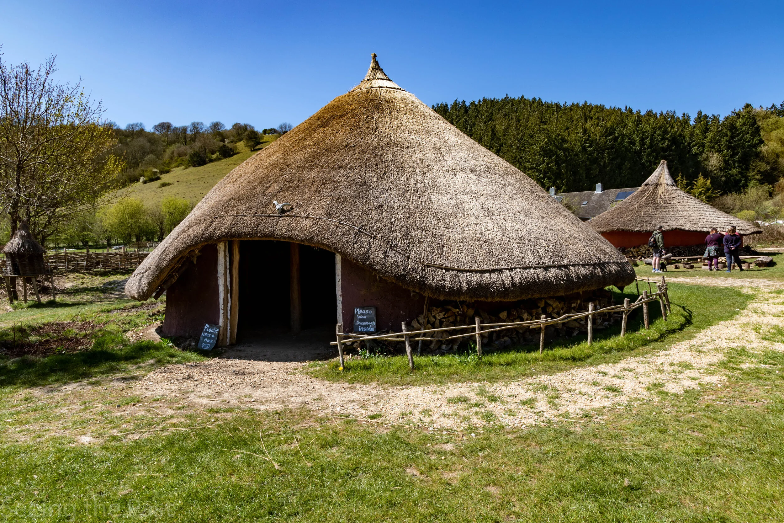
The photo above comes from a reconstruction at Butser Ancient Farm in Hampshire. It is based on the Moel Y Gerddi roundhouse discovered at LLanfair in North Wales. It is likely that some of the huts at Din Lligwy were like this.
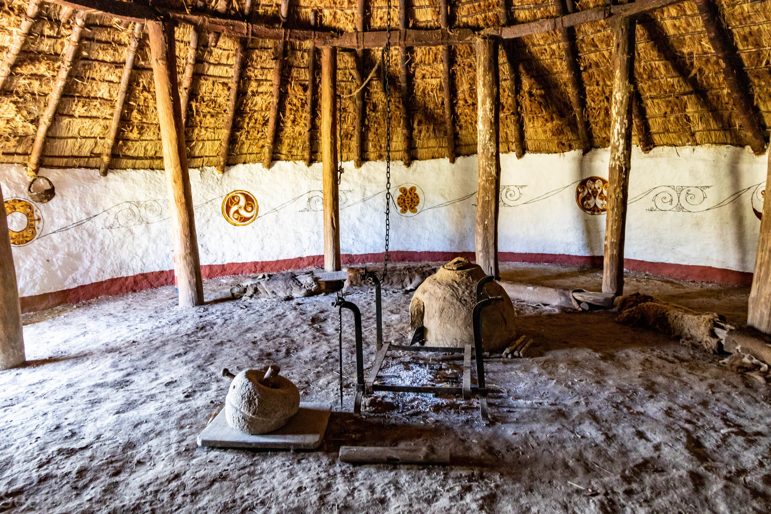
Above is the imagined interior of the roundhouse at Butser. You can see the fire for cooking and heating, a clay bread oven and in front of the fire, a quern for grinding corn to make flour.

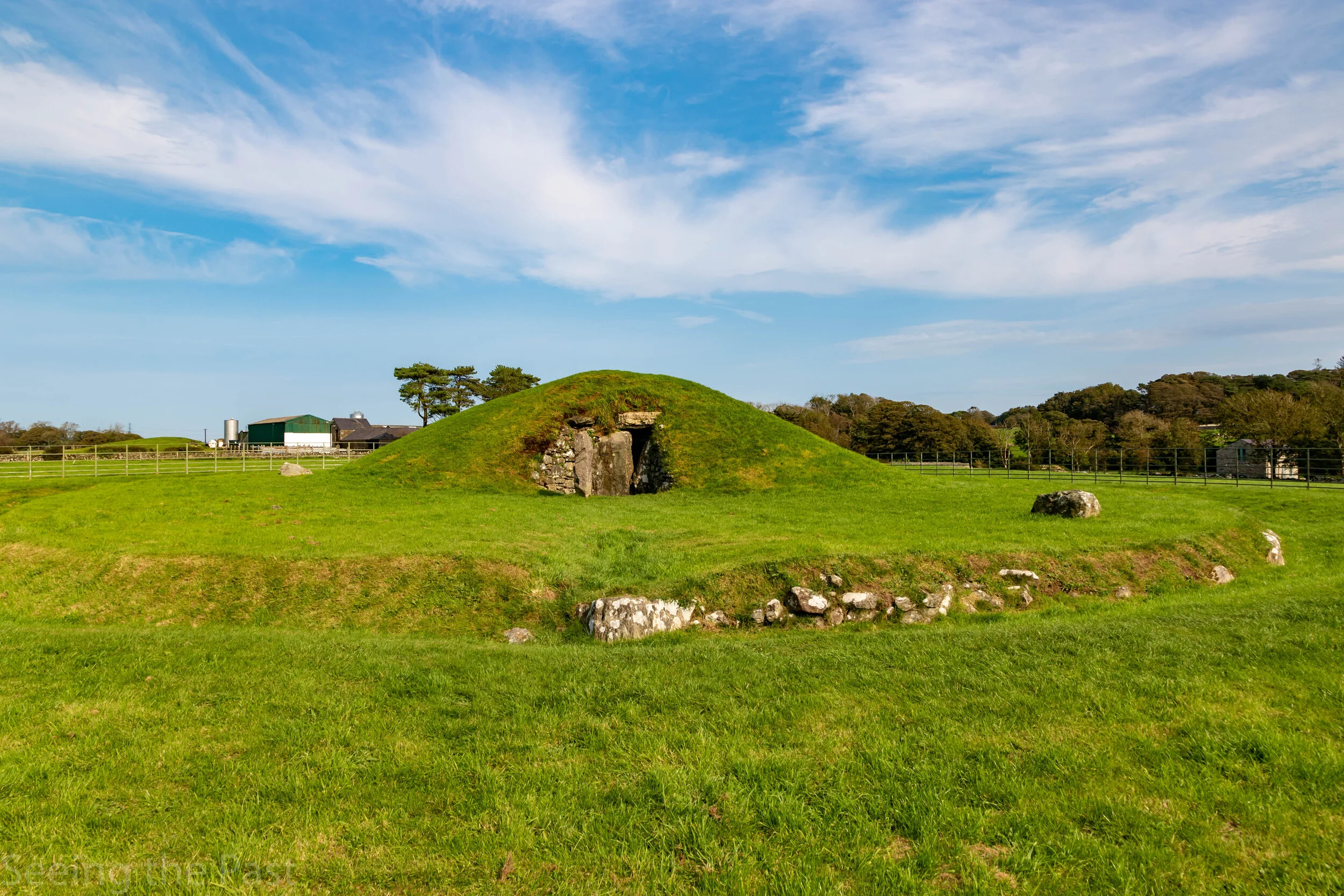
This would be similar to the view that the inhabitants of Din Lligwy might have seen. I took this photo near the wood that now blocks the view directly from the settlement.

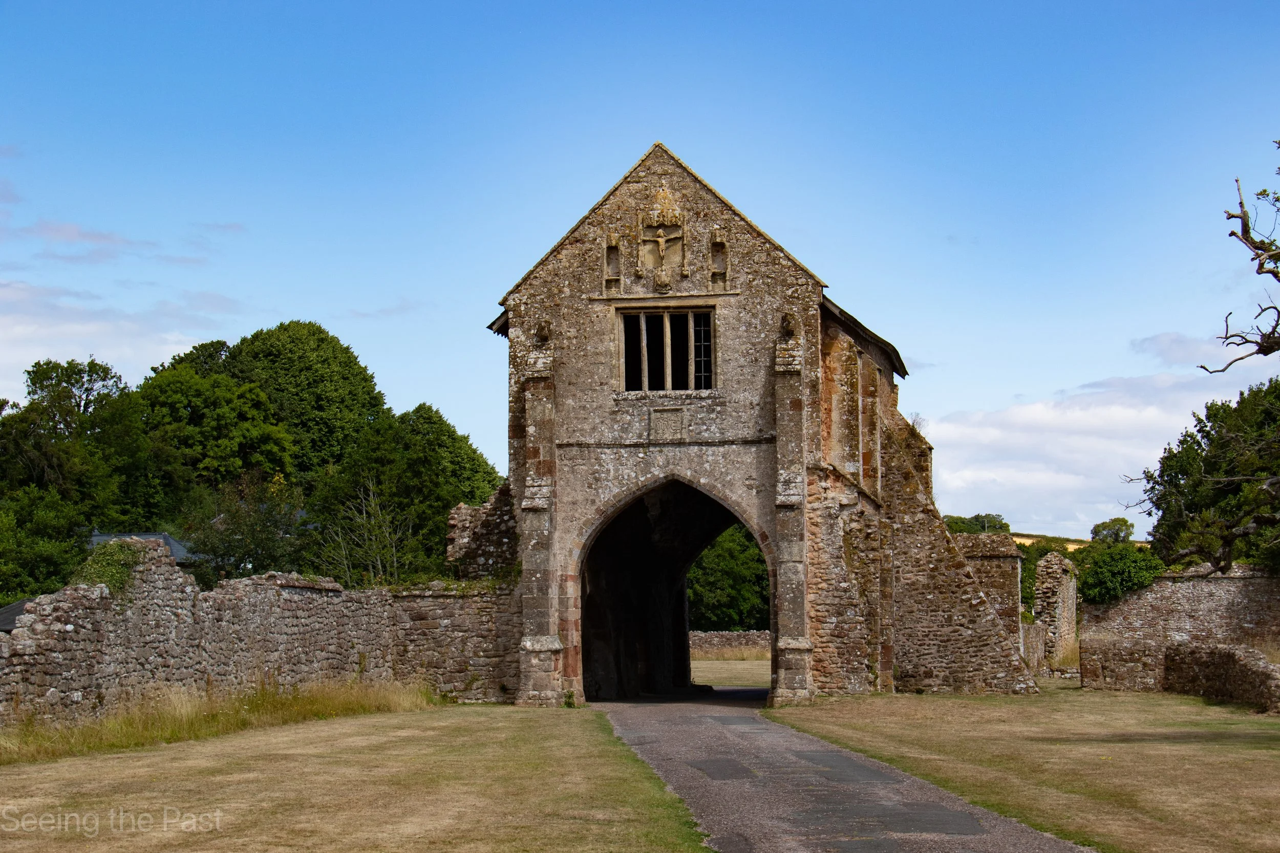
Lligwy Chapel. When walking to the settlement you will pass this interesting building. It was a small chapel for people who could not get to the main church for the parish because it was too far away. It was built in the 12th century and had additions in the 14th and 16th centuries.
Essential information.
Getting there.
Road; It is not easy to find but it is well worth the effort. 3/4m (1.2km) N of Llanallgo, off A5025. Post code LL72 8NH. Be careful when you use your sat nav because mine sent me round in circles and so I simply used the map on my phone rather than listening to the verbal instructions. There is a small lay-by to park in and a short walk across a field and through a small wood.
Tickets; None, it is free!
Facilities; None
Follow us on social media
Articles that might interest you


Visiting London? The Museum of London, is one of the best museums in the UK and is free. You can see amazing objects from thousands of years of life in London, from a Mammoth tusk to a pilgrims badge representing a visit to St Thomas Becket’s tomb. You can get up close to those objects and see their little details. The displays are bright and informative. There are rooms set out as though they were from a Roman villa placing Roman finds in context. Several models are on display such as London’s Roman forum and Basilica as well as the original gothic St Paul’s Cathedral